

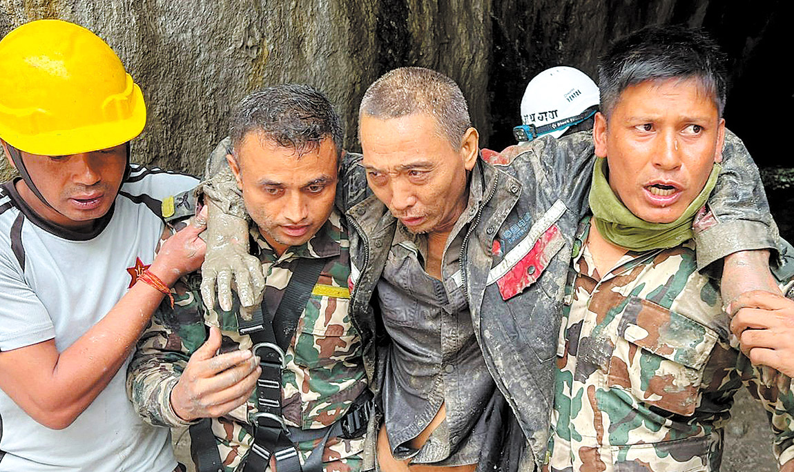
Rescue teams are carrying out painstaking searches across the disaster zone in Gyirong county, Xizang autonomous region, more than a week after a massive mudslide tore through the area, killing at least 43 people and leaving 519 missing.
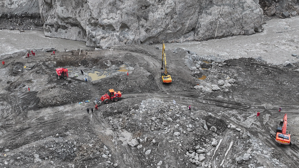
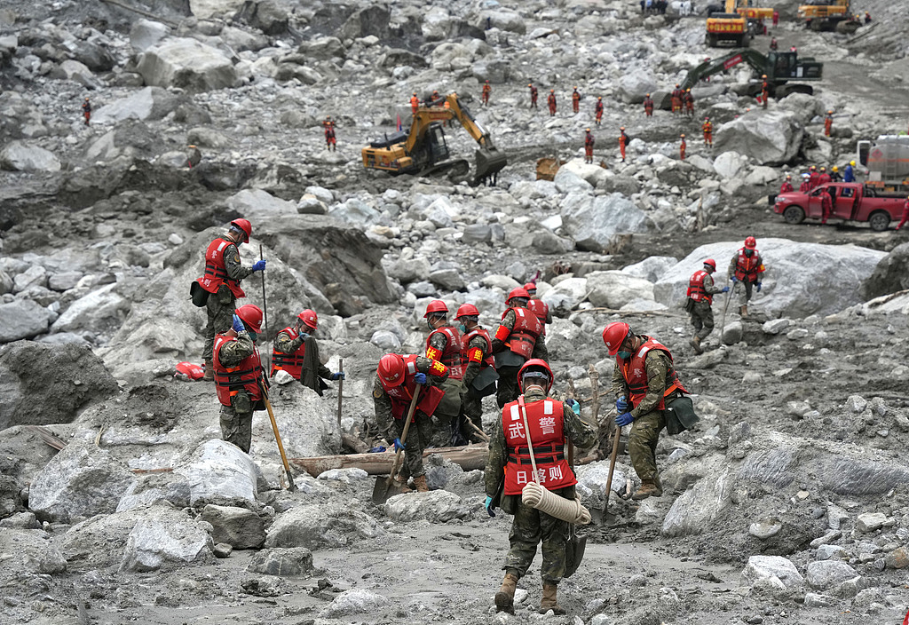
Local authorities said Sunday that the search operation had expanded across the core disaster area, with thousands of rescuers working through thick layers of mud, rock and debris. Teams have been clearing the affected ground section by section, in some locations digging down to the original foundations of buildings and other structures.
Ren Wei, commander of the frontline headquarters and executive vice chairman of the regional government, said at a news conference in Gyirong that rescuers had recovered 993 items of personal belongings by 6 pm on Saturday. The belongings are being recorded as part of the wider effort to identify people who remain missing.
More than 2,500 rescuers had been deployed by Saturday evening. They were supported by more than 500 vehicles and over 9,000 sets of rescue equipment. Drones had conducted more than 1,000 flights over the affected area, while 5.43 metric tons of supplies and equipment had been delivered by air.
Search Operations Move Into the Core Disaster Area
Access to the worst affected area improved after roads leading into the core zone were restored on Wednesday. That allowed six specialized groups and seven rescue teams to begin more detailed searches across areas that had previously been difficult or impossible to reach.
The teams are working methodically rather than simply clearing large sections of debris at once. Rescuers are removing the mud layer by layer and examining individual sections before moving farther into the disaster zone.
Some areas have already been cleared to the level of their original foundations.
Ren said the operation would continue according to the existing search plan, with teams working to cover the core disaster area as thoroughly as possible.
The scale of the operation reflects the difficult conditions facing rescuers. The disaster struck in a remote, high altitude part of the Himalayas, where terrain, weather and the continuing possibility of secondary geological hazards can complicate even basic movement and search work.
Two local villagers were rescued late last month, providing a rare breakthrough during the continuing operation.
Families Await News of Missing Relatives
Alongside the physical search, authorities are dealing with hundreds of families trying to establish what happened to relatives who remain unaccounted for.
A dedicated hotline has received 675 calls from relatives so far. Authorities have also received 791 family members who travelled to the area, with 640 provided accommodation.
For families, the identification process is likely to be as difficult as the search itself because the force of the mudslide scattered people, structures and personal possessions across the affected area.
More than 60 forensic specialists have been mobilized, together with three laboratories, according to Pu Weidong, executive deputy head of the regional public security department.
Authorities are registering recovered remains and personal belongings and collecting fingerprints, genetic information and other identifying characteristics. Those details are then being compared with information supplied by relatives.
Pu said the identification work is being conducted scientifically and carefully, with authorities also taking into account the dignity of the deceased and local customs.
The authorities have promised regular information releases covering the search, rescue and subsequent work. A 24 hour hotline has also been established so families can seek information and raise concerns as the operation progresses.
Authorities Focus on Further Geological Risks
Finding missing people is not the only concern confronting rescuers. Authorities are also working to prevent another disaster from striking the teams or communities downstream.
More than 100 experts and technical personnel have been deployed to monitor conditions around the affected area. They are using 150 sets of professional monitoring equipment to track changes in slopes, water levels and weather conditions, as well as other indicators that could signal a new threat.
Deng Buchuan, deputy director of the special disaster rescue department of Xizang Fire and Rescue, said teams were continuing to search through the mud systematically.
“I hope more people can be rescued and we will do as much as we can to the best of our ability,” Deng said.
The continuing risks are tied to the unusual geological and climatic conditions of the Himalayan region.
Su Pengcheng, a researcher at the Chinese Academy of Sciences’ Institute of Mountain Hazards and Environment, said experts had been monitoring barrier lakes, unstable slopes, glaciers and glacial lakes following the disaster.
They have also surveyed geological hazards around five villages and along the emergency route being used by rescue and support teams.
Experts Trace Disaster to Himalayan Ice and Rock Collapse
Su said the mudslide was triggered by a high altitude ice and rock collapse on the Nepalese side of the Himalayas.
The material generated by the collapse then entered a downstream channel and developed into a powerful debris flow. According to Su, the flow travelled roughly 22 kilometers downstream in only six to seven minutes.
That speed left little time for people in its path to respond, while the volume and force of the debris caused severe damage across the affected area.
A barrier lake formed after the disaster has since drained naturally, reducing one immediate source of concern. But experts warn that the danger has not disappeared.
Large deposits of unstable material and weakened slopes remain in the area. These could produce localized blockages, landslides or further debris flows, particularly if conditions change.
To monitor those risks, specialists are combining satellite and aerial remote sensing with radar, hydrological monitoring and real time drone imagery. The information is being used to assess changing conditions and issue warnings to rescue teams and people living downstream.
Su also linked the growing risk of Himalayan disasters to climate change. He called for earlier assessments of glacier related risks and a monitoring system that combines satellite, aerial and ground based information.
He also argued that countries across the Himalayan region need stronger cooperation, particularly in sharing data, assessing cross border hazards and issuing early warnings.
International Journalists Visit the Disaster Zone
The difficult conditions in Gyirong have also been observed by foreign journalists who travelled to the disaster area during a visit organized by Chinese authorities.
The State Council Information Office and the Ministry of Foreign Affairs arranged the visit on Saturday and Sunday for 17 journalists representing nine overseas media organizations. The group included journalists from the United States, Britain, Russia, India and Singapore.
Muhammad Asghar, a correspondent for the Associated Press of Pakistan in China, described the rescue response as “very quick” despite the difficulties involved in reaching such a remote location.
Bruno Falci, a Brazilian journalist with Latin American television channel teleSUR, also commented on the speed of the response. He said he was impressed by how quickly China had mobilized rescuers and restored road access to the affected area.
The visit gave foreign reporters an opportunity to see the terrain, rescue infrastructure and ongoing search work directly.
For the teams still operating in the mud, however, the focus remains much narrower. They are continuing to clear the disaster area section by section, record everything recovered and use forensic evidence to identify those who died.
With 519 people still missing, authorities say the search of the core disaster area will continue under the established operation plan. At the same time, monitoring teams will remain deployed to detect unstable slopes, changing water levels and other hazards that could put rescuers and downstream communities at risk.